Blog Detail
Explore insights, industry trends, and expert articles on 3D laser scanning, LiDAR surveying,
BIM modelling, GIS mapping, and engineering data solutions.
30 MAY
How LiDAR and BIM Improve Accuracy in Modern Engineering Projects
In today’s engineering and infrastructure environment, accurate data is essential for planning, design, execution, and long-term asset management. Technologies such as LiDAR, 3D laser scanning, BIM modelling, and GIS mapping help teams capture real-world conditions and convert them into reliable digital information.
When evaluating reality capture and engineering data workflows, businesses often focus on:
- Improving accuracy in site measurement and documentation
- Reducing rework and coordination issues during execution
- Creating reliable BIM, CAD, and GIS deliverables from real-world data
Advanced digital workflows allow engineering teams to streamline design development, reduce manual errors, and improve collaboration across project stakeholders. Here are some of the key areas to consider:
1. Why is accurate data capture important?
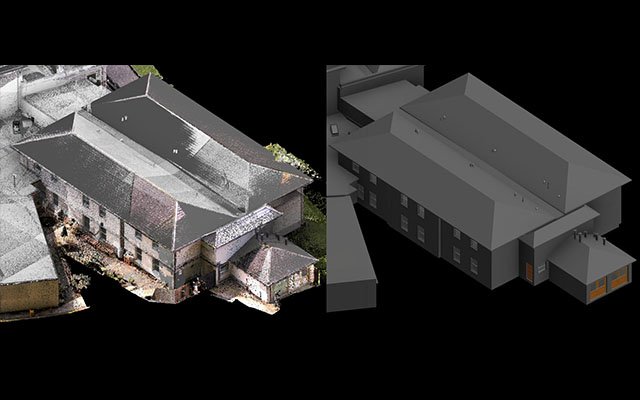
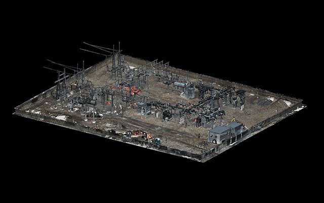
Accurate data capture forms the foundation of every successful digital engineering workflow. With 3D laser scanning and LiDAR, project teams can capture existing conditions in high detail and use that information for planning, modelling, retrofitting, and documentation.
Reliable point cloud data helps improve decision-making, reduce uncertainty, and support engineering teams with a clear understanding of site conditions before work begins.
--- Fotios Team"Accurate site data is the starting point for efficient modelling, better coordination, and smarter project execution."
2. How does BIM support project coordination?
BIM modelling helps transform raw survey and point cloud information into structured, intelligent models that can be used across design, engineering, and construction teams. This improves communication, visualization, clash detection, and documentation quality.
3. What role does LiDAR play in modern surveying?
LiDAR is widely used for capturing highly accurate spatial information across buildings, infrastructure corridors, industrial sites, and terrain. It enables faster data collection and supports topographic studies, as-built documentation, and geospatial analysis.
When supported by proper processing workflows, LiDAR data can become a valuable source for BIM modelling, CAD drafting, GIS mapping, and digital twin development.
4. How do these workflows support business efficiency?
Digital engineering workflows reduce duplication of work, improve coordination, and help project teams make faster decisions. Whether the requirement is CAD conversion, Scan to BIM, GIS mapping, or digital documentation, structured project data creates long-term value.
The right combination of technology, expertise, and quality control helps businesses deliver projects more efficiently while maintaining high standards of precision.