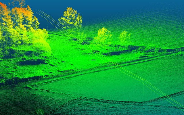
3D Laser Scanning
LiDAR Surveying
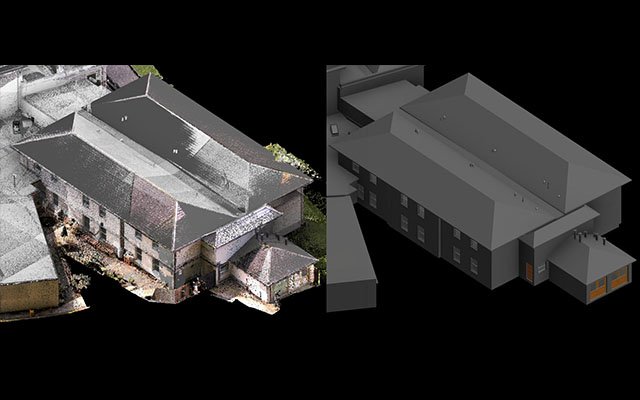
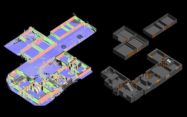
Scan to BIM Modeling
WHO WE ARE
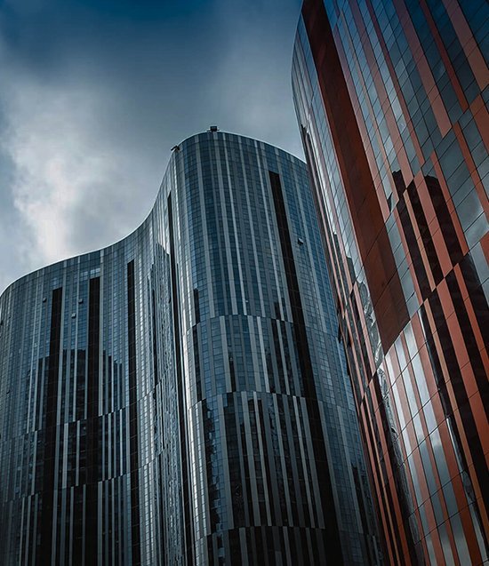
Experts in 3D Laser Scanning, LiDAR Surveying, and BIM Modeling Solutions

Our Vision
To be a trusted global provider of advanced reality capture solutions,
delivering high-accuracy 3D laser scanning, LiDAR, and digital engineering
data that empowers industries to build smarter and faster.
Our Mission
Our mission is to transform real-world environments into precise digital
models through point cloud processing, Scan-to-BIM, GIS mapping, and
engineering documentation for infrastructure, construction, and industrial projects.
Projects Delivered
+
scanning & BIM projects
Industry Expertise
+
years of experience
Industries
Industries We Serve
Engineering & Construction
BIM modeling, laser scanning, and engineering data solutions for construction projects.

Infrastructure & Utilities
GIS mapping and geospatial data solutions for infrastructure development.

Real Estate Development
3D visualization and digital modeling for real estate planning and development.
Industrial Plants
Scanning and modeling solutions for plant design, maintenance, and upgrades.
Transportation
Data-driven solutions for roads, railways, and transport infrastructure.
Oil & Gas
High-precision scanning and modeling for energy sector projects.
Our Services
Precision Engineering
& Reality Capture Solutions
High-precision 3D laser scanning services to capture accurate spatial data of buildings, infrastructure, and industrial facilities.
Read More
Advanced LiDAR technology for topographic surveys, terrain modeling, and high-accuracy geospatial data collection.
Read More
Transform point cloud data into intelligent BIM models using Revit and AutoCAD for engineering and construction workflows.
Read More
Processing and optimization of large point cloud datasets for accurate digital documentation and engineering analysis.
Read More
Create precise CAD models from scanned physical objects for manufacturing, design improvements, and product development.
Read More
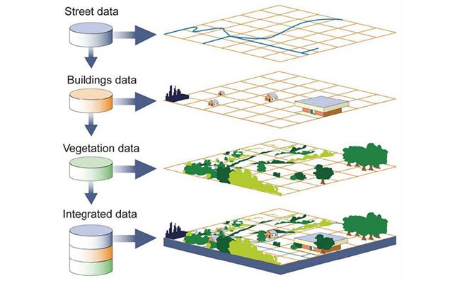
Geospatial mapping and GIS solutions for infrastructure planning, environmental analysis, and urban development projects.
Read More
Why Choose Us
Why Choose Fotios
We deliver accurate and cost-effective reality capture, LiDAR surveying,
BIM, mobile mapping, and GIS solutions with strong quality standards,
modern technology adoption, and secure data handling.


Domain Expertise
We have more than 10 years of collective experience in 3D laser scanning,
LiDAR technologies, BIM, CAD modelling, reverse engineering, and GIS services.
01
Latest Technology
We continuously adopt the latest tools, software, and workflows to deliver
productive, error-free, and high-accuracy engineering solutions.
02
Quality & On-Time Delivery
Our strong QA and QC process helps us maintain high quality standards,
customer focus, and timely project delivery across every assignment.
03
Data Security
We follow strict data confidentiality, backup, and file management protocols
to ensure secure handling of client data throughout the project lifecycle.
04
+
years of
experience
experience
+
completed
projects
projects
+
core service
areas
areas
%
focus on quality
and precision
and precision
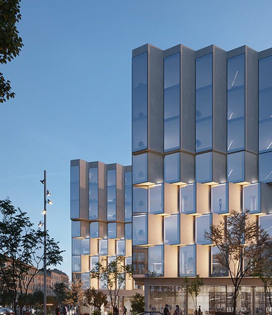
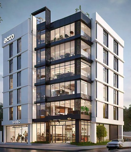
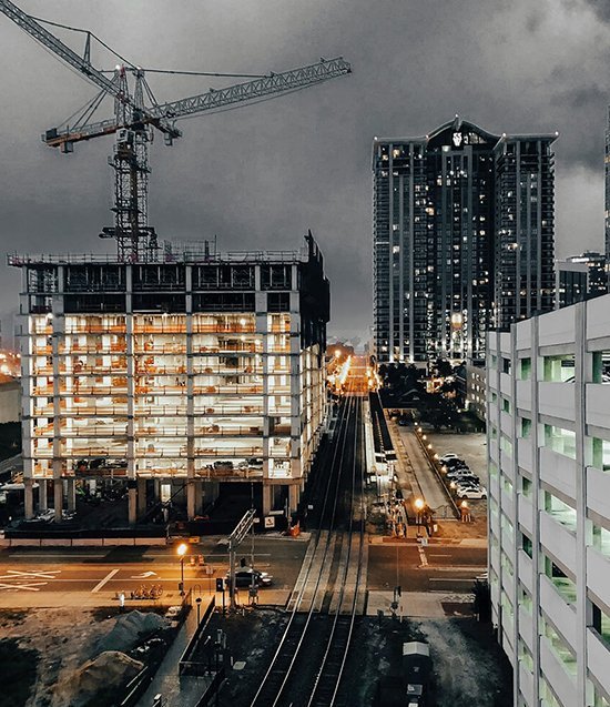
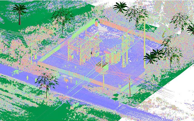
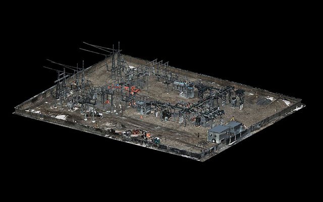
Our Projects
Delivering Accurate
Reality Capture & Engineering Solutions

Contact Us
Let’s Discuss Your Project
We’d be glad to understand your requirements in 3D laser scanning, LiDAR surveying,
BIM modelling, GIS mapping, and engineering data solutions. Complete the form and
our team will get back to you shortly.
Call Us
+91 XXX XXX XXXX
Email Us
info@fotios.in
Working Hours
Mon - Sat: 09am - 06pm
Location
India
Our Blog & News